



Kite Info
Aerial Photography
Kite aerial photography has been used since the 1880s for mapping, surveillance and art. Fly360 shares its own experience shooting stunning images from kite-mounted cameras.
Aerial photography began in 1858 with a kite and a camera strapped to a string. In 2025, most aerial photographers use drones. But the kite remains, as Fly360 continues to demonstrate, the most versatile, most poetic, and in many circumstances the most practical aerial photography platform ever devised.
The History of Aerial Photography: From Nadar to Drones
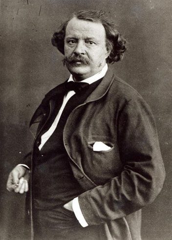
The first aerial photograph in history was taken in 1858 by French photographer Gaspard-Felix Tournachon, known as Nadar, from a tethered hot-air balloon 80 metres above Paris. It took him three years of experimentation to achieve this. In 1855, he had patented the idea of using aerial photographs for mapmaking and surveying. The oldest surviving aerial photograph is James Wallace Black’s image of Boston, taken from a balloon in 1860. By the 1880s, kites were being used to lift cameras — offering a simpler, cheaper, and more controllable aerial platform than balloons. Both World Wars saw extensive use of aerial photography for reconnaissance, mapping, and military planning.
The Four Types of Aerial Photography
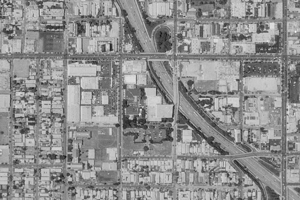
Aerial photography today is classified into four main types based on camera angle and output format. Oblique photography captures the landscape at an angle, showing both terrain features and the horizon — useful for topographic surveys and landscape documentation. Vertical photography shoots straight down, producing plan-view images used in mapping and cadastral surveys. Combination photography merges oblique and vertical approaches for comprehensive coverage. Orthophotos are geometrically corrected aerial images where scale is uniform across the frame, used in GIS mapping and land-use planning. Fly360’s kite aerial photography platform can produce all four types depending on camera orientation and altitude.

Vertical and Orthophoto Aerial Photography
Vertical aerial photography shoots the camera pointed directly downward, capturing a plan-view of the terrain below. This type is the foundation of modern cartographic mapping — every topographic map, land-use survey, and GIS dataset draws on vertical aerial imagery. Orthophotos take this further: they are geometrically corrected to remove the distortions caused by terrain elevation and camera tilt, producing images where every point is at true map scale. Fly360’s kite aerial photography rigs can be configured for vertical capture, making them suitable for archaeological site documentation, heritage surveys, and environmental monitoring at locations where drones are prohibited.

Kite Aerial Photography: The Fly360 Advantage
Fly360 operates purpose-built kite aerial photography rigs that outperform drones in specific scenarios: extended flight time (hours vs 30-40 minutes), silent operation, zero battery constraints, permitted in most restricted airspace, and deployable by two people in under 15 minutes. The camera hangs on a stabilised pendulum below a large, stable kite, and is triggered remotely from the ground. Fly360 has used kite aerial photography at coastal sites, heritage locations, and festival grounds across India — producing high-resolution panoramic images that are simply not achievable by any other means in those environments.
Gallery

Frequently Asked Questions
Who took the first aerial photograph in history?The first aerial photograph was taken in 1858 by French photographer Gaspard-Felix Tournachon (Nadar) from a tethered hot-air balloon 80 metres above Paris. The oldest surviving aerial photograph is James Wallace Black's image of Boston, taken from a balloon in 1860.What are the four types of aerial photography?The four main types are: oblique (angled view showing terrain and horizon), vertical (straight down, used in mapping), combination (merging oblique and vertical), and orthophotos (geometrically corrected vertical images at uniform scale for GIS and mapping applications).What is kite aerial photography?Kite aerial photography (KAP) uses a camera suspended below a large, stable kite to capture aerial images. It predates drone photography by over a century, operates for hours (vs 30-40 minutes for drones), and is permitted in many locations where drones are restricted.Does Fly360 offer aerial photography services?Yes. Fly360 operates kite aerial photography rigs for events, festivals, tourism documentation, archaeological surveys, environmental monitoring, and heritage site documentation. The system is deployable by two people in under 15 minutes.What is the difference between a drone and a kite for aerial photography?Drones are battery-powered and typically fly for 30-40 minutes before requiring a battery change. Kites are wind-powered, can fly for hours, operate silently, and are permitted in many restricted airspace zones where drones are prohibited. Kites are optimal for extended coverage in areas with regulatory restrictions.